Saturday, April 19, 2025
HomeFreedivingGoogle Maps dives underwater

Google Maps dives underwater

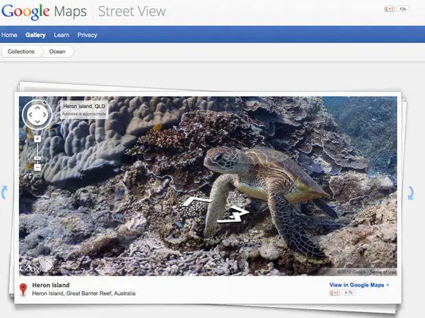
Google announced at the Blue Ocean Film Festival in Monterey the latest updates to their Google Maps product with underwater panoramas.

Google partnered with the Catlin Seaview Survey, and used a specially designed underwater camera, the SVII, to capture the photos.

Six locations spread across the Great Barrier Reef, Hawaii and the Philippines have so far been mapped out.

[youtube http://www.youtube.com/watch?v=7syWPIZt9B4]


Stephan Whelan
Stephan Whelanhttps://www.deeperblue.com
Stephan is the Founder of DeeperBlue.com. His passion for the underwater world started at 8 years old with a try-dive in a hotel pool on holiday that soon formulated into a lifelong love affair with the oceans. In 1996 he set up DeeperBlue.com and has grown the site to be the most popular diving website and community in the world.

SEARCH

CONNECT WITH US

858,282FansLike
113,064FollowersFollow
2,738FollowersFollow
22,801FollowersFollow
13,177FollowersFollow
25,921FollowersFollow
2,531SubscribersSubscribe

RECENT ARTICLES